


Autaugaville, Autauga County, Alabama
About
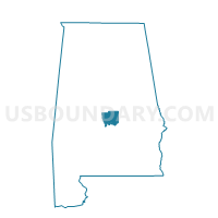
Outline

Summary
| Unique Area Identifier | 521150 |
| Name | Autaugaville |
| County | Autauga County |
| State | Alabama |
| Area (square miles) | 66.03 |
| Land Area (square miles) | 63.46 |
| Water Area (square miles) | 2.58 |
| % of Land Area | 96.10 |
| % of Water Area | 3.90 |
| Latitude of the Internal Point | 32.43150760 |
| Longtitude of the Internal Point | -86.66837530 |
Maps


Graphs
Select a template below for downloading or customizing gragh for Autaugaville, Autauga County, Alabama


Neighbors
Neighoring Voting District (by Name) Neighboring Voting District on the Map
- Booth Volunteer Fire Department, Autauga County, AL
- Independence Voting Center, Autauga County, AL
- Lowndesboro CME Church Voting District, Lowndes County, AL
- Mulberry/Statesville, Autauga County, AL
- Safe Harbor Ministries, Autauga County, AL
- White Hall Town Hall, Lowndes County, AL
Top 10 Neighboring County Subdivision (by Population) Neighboring County Subdivision on the Map
- Prattville CCD, Autauga County, AL (42,682)
- Autaugaville CCD, Autauga County, AL (3,320)
- Billingsley CCD, Autauga County, AL (2,894)
- Lowndesboro CCD, Lowndes County, AL (905)
Top 10 Neighboring Place (by Population) Neighboring Place on the Map
Top 10 Neighboring Unified School District (by Population) Neighboring Unified School District on the Map
Top 10 Neighboring State Legislative District Lower Chamber (by Population) Neighboring State Legislative District Lower Chamber on the Map
Top 10 Neighboring State Legislative District Upper Chamber (by Population) Neighboring State Legislative District Upper Chamber on the Map
Top 10 Neighboring 111th Congressional District (by Population) Neighboring 111th Congressional District on the Map
Top 10 Neighboring Census Tract (by Population) Neighboring Census Tract on the Map
- Census Tract 211, Autauga County, AL (3,320)
- Census Tract 208.01, Autauga County, AL (3,081)
- Census Tract 7810, Lowndes County, AL (2,932)
- Census Tract 210, Autauga County, AL (2,894)